- -
What is 2D Hydraulic Modeling?
Carpenter Marty Transportation can take your bridge, stream, and floodplain improvement projects to the next level. Our team’s use of 2D modeling can provide more accurate results for hydraulically complex projects to help determine the most cost-effective solutions. What does this mean and how can it be used on your project? Read on to find out.
What is Hydraulic Modeling?
Hydrology and hydraulics are the study and analysis of water movement and flow in streams, rivers, storm sewers, and other infrastructure. The study and analysis focus on water’s natural movement, rainfall and evaporation effects, and how expansion or restriction of the flow influences the area.
So what is exactly is hydraulic modeling? It’s the use of computer software to simulate the effects of water flow. It’s used to show how the water will move through a specific space. The software is used to determine ways to reduce the amount of flooding and impacts to the areas surrounding a potential project. Civil engineers use this modeling to make informed decisions to select and implement construction projects so that they have the least amount of flooding risk to project surroundings. Carpenter Marty Transportation uses various types of software to complete these types of studies, including Aquaveo SMS to create SRH-2D models, Hydrologic Engineer Center- River Analysis System (HEC-RAS), and FHWA Hydraulic Toolbox.
What is the difference between 1D vs. 2D?
Traditional 1D hydraulic modeling assumes water movement in one dimension – upstream to downstream. Cross sections are set, and water is assumed to flow perpendicular to these sections. For most projects, 1D modeling is adequate for hydraulic analysis. Project sites with more complicated hydraulics such as multiple channels, stream confluences, or multiple bridge openings can be more difficult to model using 1D analysis.
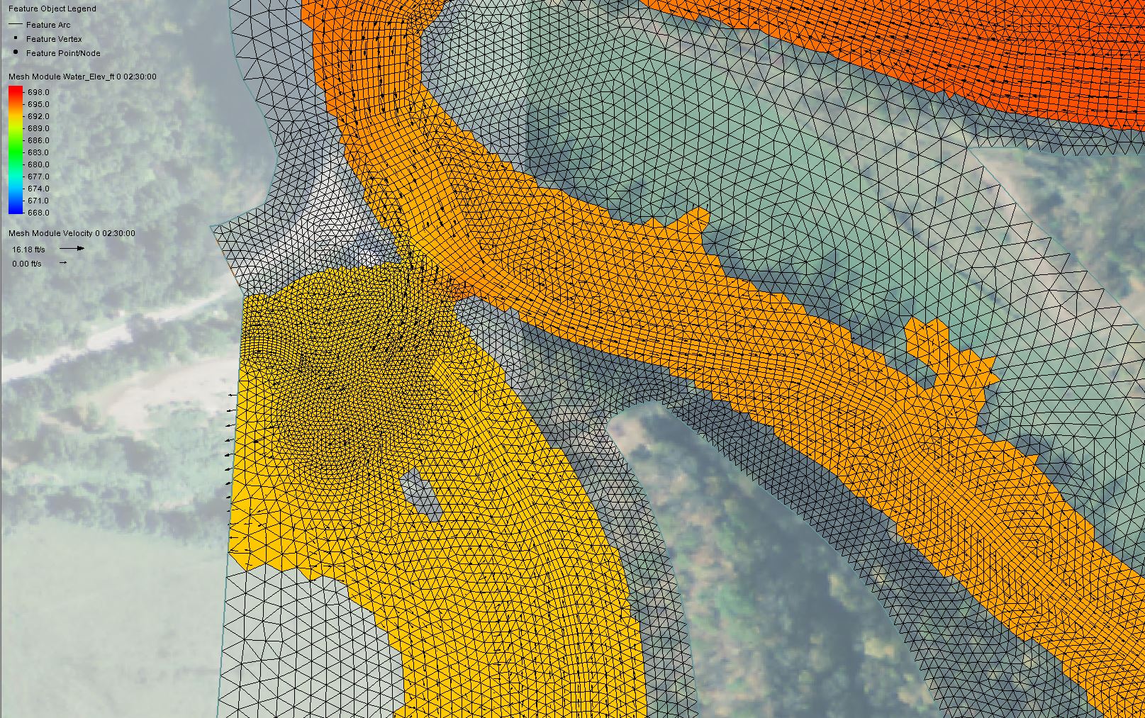
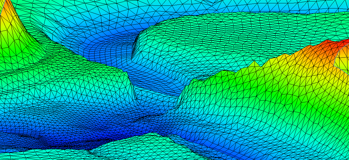
2D hydraulic modeling provides an even better understanding of the flow. 2D models take into consideration that water can move two dimensionally, and not just perpendicular to assumed cross sections. This type of modeling can show more accurate, better detailed results because it requires fewer assumptions. And contrary to rumors, this type of modeling can be done in about the same amount of time as traditional 1D modeling.
What projects can benefit from CM’s 2D modeling services?
1D hydraulic models are acceptable for most projects. 2D modeling can be used for a variety of projects when increased detail is required. State departments of transportation are slowly shifting towards requiring 2D modeling on more hydraulically complex projects. The updated Ohio Department of Transportation Location & Design Manual is an example of this.
CM uses the 2D technology on a variety of projects including:
- Structure Type Studies - This modeling can show the impacts of various bridge types on the rivers and streams they cross. The modeling can help determine the best and most cost-efficient structure to construct to reduce floodplain impacts and flooding to areas surrounding the project.
- In Stream Structures - This modeling has been used to show how the water will flow around and over the dam structure. 2D modeling was used on our recent Jug Structure project in Tyler County, WV. The modeling evaluated the existing hydraulic conditions at the low water crossing and determined floodplain impacts for various proposed design alternatives. The project is still in the design phase.
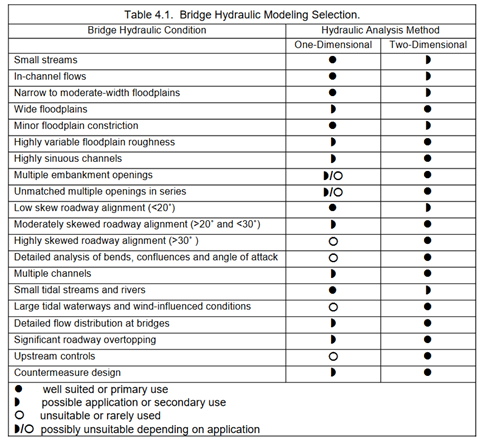
Publication No. FHWA-HIF-12-018 Hydraulic Design Series No. 7
